
Search a Grants Pass Street
Use an address as a record key, not as a person search. Josephine County Property Assessment & Tax Data covers county parcels, including some with a Grants Pass mailing address outside city limits. Its property detail can identify the situs, map number, legal description, owner field, and sales history. The result is evidence about a parcel and its recorded ownership. It is not a list of every household member or a claim that the owner receives mail at the parcel.
- Enter the street number and name in JCPA. Keep the directional prefix, street type, and any unit notation. The portal advises a shorter number-and-street search when a full address fails.
- Open the matching property card and save the situs address, account or map number, and legal description. Check the map-search route if an identifier is unknown.
- Read the sales-history rows for an instrument number and the buyer and seller roles. Those fields connect the parcel to the recorded-document trail.
- Search the instrument number or party name in the Clerk's Digital Research Room. If an image is missing or a certified copy is needed, use the Recording Division counter, phone, or written copy route.
- For an older address, ask a local collection whether it holds a reverse or criss-cross directory for the exact year. Pair any listed entry with its printed date and source.
That order gives a Grants Pass street directory search a stable core: parcel first, document second, dated historical evidence last. Oregon's My Vote tool is self-service for a voter and ballot status, not a public browse-by-street roll, so it does not replace this workflow.
Grants Pass Street Directory Fields
The JCPA search surface accepts more than one kind of address clue. A short address can begin the search, but a map number or account can rescue the work when street formatting has changed. Guest access is offered with some functions restricted, and the portal requires CAPTCHA verification before login. Its public landing page does not give an earliest online coverage year, so an apparent gap should lead to the Assessor or archival routes rather than an assumed cutoff.
| JCPA field or mode | Input | How it helps by street |
|---|---|---|
| Property Search | Combined text | Accepts an address, tax-lot ID, or property identifier. |
| Owner / party | Indexed lookup | Finds ownership records, not an occupancy roster. |
| Account / Property ID | Text with alphabetic prefix | Returns a known parcel after a map or result-table match. |
| Tax lot / Map ID | Dashed township-range-section pattern | Supplies a durable key for the legal description. |
| Map Search | Map browse | Locates a parcel when the identifier is unknown. |
| Select Columns / Export | Result controls | Shows property ID, situs, map number, legal description, neighborhood, subdivision, and type. |
The property-result screen shows the selectable columns available for a Grants Pass street directory search.
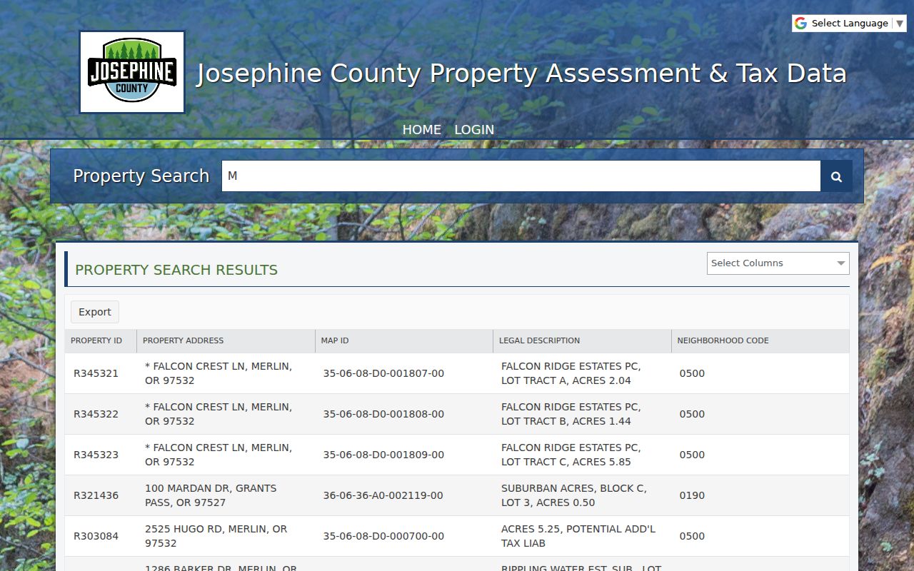
Use those columns to distinguish similarly named streets and preserve the parcel key before moving to a document index. The table narrows the record trail; it does not identify everyone connected with an address.
Note: JCPA has no stated earliest online coverage date, so a missing result requires another access channel.
Grants Pass Street Directions Matter
Grants Pass uses a directional grid that can change a search result. The Southern Pacific Railroad main line separates north and south, while 6th Street and Williams Highway separate east and west. The City code assigns NE, NW, SE, and SW prefixes from those dividers. Leave off a prefix and an address can land in a different quadrant. The City also uses recognized street suffixes and unique secondary-unit designations, so retain the source spelling rather than standardizing an old record too early.
- Parcel
- A defined piece of land carried in the assessment and mapping system.
- Situs address
- The physical location of that parcel for mapping. It can differ from the owner's tax-contact address.
- Legal description
- The lot, block, subdivision, or map-based language that identifies land apart from a street string.
- Plat
- A recorded map that lays out lots, blocks, streets, or subdivisions.
- Criss-cross directory
- An address-to-listing directory, only useful after a collection confirms the year and format it holds.
City numbering also generally puts even numbers on the north or west side of a linear street and odd numbers on the south or east. That can flag a transcription problem, but it does not prove an address without City or postal verification.
Map a Grants Pass Street
The County Property Data Map is useful for placing a street segment in its parcel context. Its Taxlots layer supports account number, owner name, MapNum, and general map searches, with an export option. The popup can expose a map number, account, tax lot, situs, street name, legal acres, and links back to Assessor data. Browse to the target lot, record the identifiers, then open each relevant property card one at a time.
The wider Josephine County GIS services directory lists Assessor, boundary, parcel, planning, road, transportation, utility, and precinct service families. Parcel shapes and city-limit or zoning layers provide geographic context. They do not establish current occupants or a social relationship between nearby parcels. For a boundary question that needs legal precision, the County Surveyor holds surveys, plats, and government-corner material.
Note: Map imagery is a visual reference, while recorded surveys and legal descriptions control a boundary question.
Survey a Grants Pass Street
When a street question turns on an old lot line, a recorded survey is the stronger source. The Josephine County Surveyor holds survey and corner records, property and boundary material, plats and maps, government-corner information, and aerial imagery reaching to the mid-1850s. Its counter is at 500 NW 6th Street and has published Tuesday through Thursday hours of 9 a.m. to 12:30 p.m. and 1:30 to 4 p.m.; the telephone is 541-474-5311. The County Surveyor is the route for a legal boundary question, not a replacement for the Assessor's ownership record.
The map number and legal description from that address search make the surveyor request more precise. They also help connect a historic plat or old street form to the current parcel without relying on a visual estimate.
Follow a Grants Pass Sales Instrument
A JCPA sales row is the handoff between the property record and a deed search. It can show a sale date, seller, buyer, instrument number, reported price where available, and an instrument type such as warranty deed, bargain and sale, personal representative, death certificate, or miscellaneous recorded document. Keep the legal description and map number beside the document number. A similar name or street address alone can join the wrong record, especially when an older source uses a different form of the address.
Useful record bridge. Start the Clerk search with the sales-history instrument number, then use the buyer or seller role to move backward through the chain.
The Digital Research Room is the first online route for recorded documents. Its disclaimer says displayed images are not certified and the index can be corrected. The Josephine County Recording Division provides a counter at 500 NW 6th Street, Room 170, weekday recording hours of 8 a.m. to noon and 1 to 4 p.m., a direct recording line at 541-474-5240, and copy-request access. For a record outside online results, the division directs researchers to the Oregon State Archives and Rogue Valley Genealogical Society.
Note: The Clerk disclaimer says displayed images are not certified, even when an index result appears online.
Grants Pass Address Permit Files
Property documents explain title, while a permit or planning record can add a dated project layer for a parcel inside Grants Pass. The City Building Division uses plan-review tracks and E-Permitting, but no verified public address-result search was found. The accurate fallback is a targeted request to the City Recorder or Community Development office that identifies the address, date span, permit number if known, project type, final inspection, planning decision, or recorded-plat reference. A project applicant is not evidence of long-term residence.
The City's building plan-review reference describes the local route for these records.
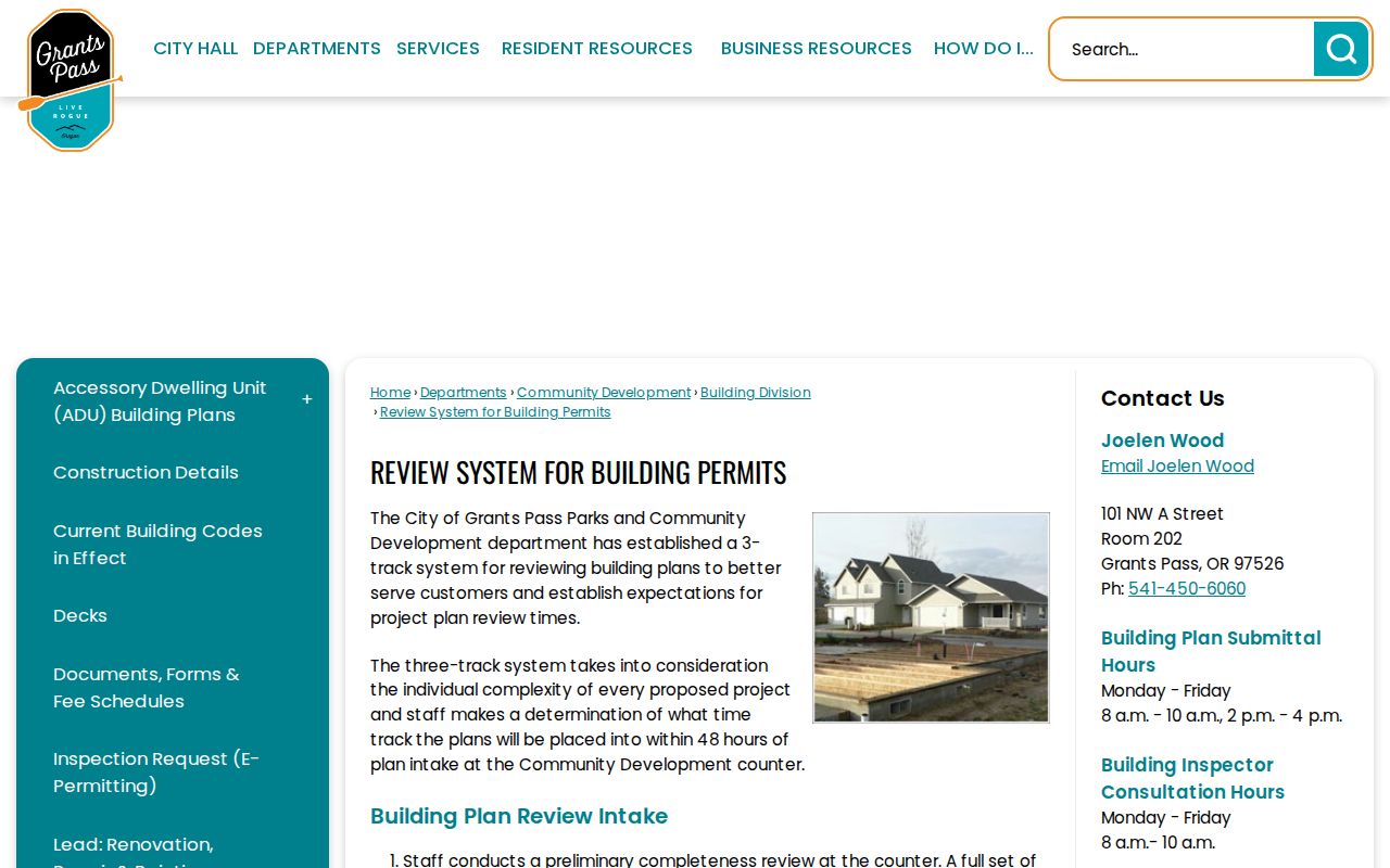
For an unincorporated Josephine County parcel, use the county's SmartGov parcel search or contact Building Safety and Planning through the routes published in JCPA. City and county permit systems are separate, so confirm which jurisdiction holds the address before requesting a file.
Keep Grants Pass Street Names
Historic address work needs the spelling that was used at the time. The City grid is a modern aid, not a reason to force a nineteenth-century reference into a present-day form. The National Register material for the G Street historic district notes associations of SW G Street with “Front” and “Main.” Search those variants before treating a negative result as proof of absence. A dated Sanborn sheet can place a building and street layout, but it cannot identify a household.
Josephine Community Library lists local-history resources, and the Josephine County Historical Society Research Library is the in-person route for documents, maps, newspapers, and family histories. Ask whether a specific year has a city or reverse directory before using it for an address search. The collections themselves are described in the Grants Pass city directories resource.
Note: A reverse directory must be verified by collection year before it supports an address finding.
Grants Pass Street Records by Address
Several systems can be read together, but they answer different questions. Use the parcel's legal description or map number as the cross-system key. A street name helps find the starting point; it is less durable when an address has changed, a parcel is vacant, or a historic source uses a block-and-lot reference.
| Address record | Local keeper | Best street-level use | Available route |
|---|---|---|---|
| Assessment and tax detail | Josephine County Assessor and Treasury | Situs, owner field, mailing field, map and legal description, sales history | JCPA guest portal or Assessor counter |
| Parcel and GIS layers | County GIS and City GIS | Parcel placement, boundaries, districts, and planning context | Map browse, then property card |
| Recorded documents | Josephine County Clerk & Recorder | Deeds, liens, plats, easements, contracts, and party roles | Digital Research Room, counter, phone, or copy request |
| Permit and planning files | Grants Pass or Josephine County | Project and review history for the named parcel | Jurisdictional portal, counter, or targeted request |
| Historic holdings | State Archives and local repositories | Older deeds, maps, directories, newspapers, and similar dated evidence | Inventory, collection desk, and repository request |
A result should label the source used: owner record, recorded party, permit reference, map context, or dated directory entry. That keeps the evidence useful without turning one type of record into another.
Grants Pass Street Recording Alerts
Josephine County advertises a Property Recording Alert Service that sends same-day links for new county recordings. It is useful for keeping watch on later filings connected to a parcel. It does not search earlier instruments, provide a title opinion, or prevent fraud. For a historical address question, the recorded-document index and archive routes remain necessary.
Use an alert as a forward-looking notice only. Save the alert's document link with the parcel identifiers, then verify any document at the Clerk when the exact image, completeness, or certification matters.
Limits of Grants Pass Street Results
A property roll identifies ownership and tax-contact data, not all people associated with a home. The public map and deed index have the same limit. Oregon voter information has statutory restrictions, and the My Vote service is not a public street-browse directory. Driver address data, utility customer lists, sealed court matters, and protected address information are not ordinary street-search results. The Oregon Address Confidentiality Program and eligible public-body confidentiality requests can further protect an address.
Lawful use. Use Grants Pass street records for personal, civic, family, or property-history research. Never use an address trail to stalk, harass, intimidate, or harm anyone.
Note: A tax-mailing address may be a post-office box, agent, estate contact, or another property, not proof of residence.